

Discover World Geography with the Our Earth Globe A4 NTR Chart
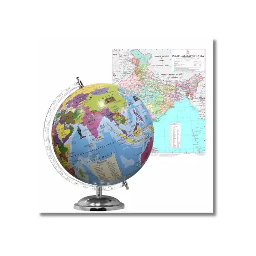
Introducing foundational geography and spatial awareness during early childhood builds global understanding, curiosity, and strong general knowledge. Consequently, the Our Earth Globe A4 NTR Chart showcases our planet’s physical layout through an intuitive, vibrant spherical model that young learners grasp effortlessly. Students quickly learn to identify the seven continents, five major oceans, the Equator, Prime Meridian, and Northern/Southern Hemispheres. For custom educational prints, school wall maps, and student identity solutions, explore specialized printing services at pvccardprinting.in.
100% Waterproof & Tear-Resistant Synthetic Construction
Standard paper world maps tear around pinholes, curl along edges during humid weather, and crease under energetic student handling. In contrast, our NTR charts are printed on multi-layer synthetic polyolefin substrate that is completely waterproof, smudge-resistant, and tearproof. Furthermore, the wipe-clean protective surface allows educators and parents to easily sanitize dust, dirt, and accidental liquid spills using a damp cloth without fading the vivid ocean blues and landmass hues.
High-Definition Color Clarity with Child-Safe Rounded Corners
Precise continental contours, distinct color coding for land and water, and clear topographic labels make every geographical feature legible from across the classroom. Therefore, every chart is produced using high-precision digital CMYK offset technology that delivers sharp visual detail and rich chromatic contrast. Additionally, precision die-cut rounded corners eliminate sharp edges, ensuring safe handling for primary school children and kindergarteners during interactive map activities.
Technical Specifications Table
People Also Ask (PAA) FAQs
What key geographical concepts are illustrated on the Our Earth Globe A4 chart?
The chart highlights fundamental geography concepts including the 7 continents (Asia, Africa, North America, South America, Antarctica, Europe, Australia), the 5 oceans (Pacific, Atlantic, Indian, Arctic, Southern), Earth’s rotational axis, the Equator, and the North and South Poles.
Can teachers wipe clean or sanitize this geography chart in classrooms?
Yes, the chart is extruded from 100% synthetic polymer rather than paper. You can easily wipe away dust, stains, or liquid splashes with a damp cloth or mild sanitizing wipe without damaging the printed graphics.
Why choose an NTR synthetic chart over a regular paper globe poster?
NTR synthetic charts are completely tearproof and waterproof through their material core. Consequently, unlike paper charts, they will not fray at the corners, absorb moisture during monsoons, or tear when handled by young students during hands-on social studies drills.
Is customisation available for schools, geography labs, and coaching centres?
Yes, bulk institutional customisation—including adding school logos, custom geographic coordinates, bilingual labels (Hindi/English), and adhesive wall mountings—is available directly through pvccardprinting.in.
Looking for other essential document printing? We offer a wide range of premium, durable PVC cards tailored to your needs. Easily carry your medical details with our PVC Ayushman Bharat Health Card and standard PVC Health ID Card. We also provide specialized state and national ID printing, including the PVC Voter ID Card, the Andhra Pradesh Driving Licence PVC Card, and the TNPDS Smart Ration Card for Tamil Nadu.
If you are looking for canteen access, you can also print your KPKB MHA Canteen PVC Card directly with us.
Related products


Single File

Retail & Shops
General Store Visiting Card (Business Card) (20 PVC Card, One Side, 300 Micron Thickness)

ID Cards
Insurance